.jpg)
How Are Floods Measured? Key Metrics & Tools Explained
How Are Floods Measured: Key Points
- Stream gauges are the main instruments used to measure floods, recording real-time water levels, also known as stream or river stage
- Advanced technology, like radar sensors, remote weather stations, and satellite imaging enhance accuracy and early detection
- Flood stages (Action, Minor, Moderate, Major) help define severity and trigger emergency response actions
- Accurate flood data supports quicker disaster response, better evacuation planning, and more reliable damage assessments
Floods are one of the most common and devastating natural disasters in the United States – causing more than $20 billion in property damage annually.
But how do we measure them?
And how can this information help you protect your property and plan your response?
Knowing how floods are measured helps you make informed decisions, respond faster during emergencies, and understand the level of risk.
This guide breaks down:
- How floods are measured using stream gauges, sensors, and satellite data
- The tools and technologies used to track rising water levels and flood intensity
- Why accurate measurement matters for emergency response and insurance claims
Key Metrics for Flood Measurement
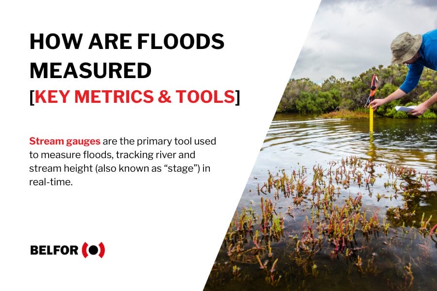
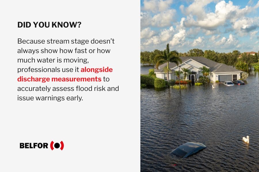
The primary method for measuring floods is stream stage, which is the height of the water surface in a river or stream relative to a fixed point.
This measurement is taken using stream gauges – permanent devices installed along rivers and waterways by agencies like the U.S. Geological Survey (USGS).
To measure floods accurately, professionals look at several key indicators:
- Water height (stage): The vertical distance from a fixed reference point to the surface of the water. When this stage exceeds certain thresholds, a flood warning is issued.
- Flow rate (discharge): Measured in cubic feet per second (cfs), this calculates how fast and how much water is moving through a river or stream.
- Flood stage thresholds: Predefined limits that indicate when water levels will begin to overflow banks and threaten property or lives.
- Rainfall intensity and accumulation: Meteorological data is used to predict flash floods or extended flooding based on how much rain falls over time.
- Geographic data: Satellite imaging and GIS (Geographic Information Systems) help map flooded areas in real time.
Pro tip: Water levels can rise rapidly during storms. Monitoring real-time flood gauges near your property can help you act faster and reduce long-term damage
Tools and Technologies Used to Measure Floods
Measuring floods accurately requires more than just a ruler at a riverbank.
Today’s experts rely on a range of high-tech tools and proven field methods.
1. Stream Gauges (Stage Sensors)
Stream gauges are installed along rivers and streams to measure the water level or “stage.” These gauges provide real-time data to help emergency services and communities track rising floodwaters and issue alerts.
Pro tip: Keep an eye on your local USGS stream gauge station data – available online in real time – to monitor rising water levels near your home or business.
2. Rain Gauges and Radar Systems
Rain gauges record the amount of precipitation in each area, while Doppler radar tracks the movement and intensity of storms.
Together, they provide early warnings for flash floods and help meteorologists anticipate where flooding may occur.
Pro tip: Use weather apps that integrate Doppler radar and rainfall alerts so you can react quickly to flash flood warnings in your area.
3. Satellite Remote Sensing
Satellites equipped with specialized sensors capture flood extents and water movement from space.
These images help emergency teams understand the full scale of a flood – especially in remote or inaccessible areas.
Pro tip: Satellite data is especially valuable after major disasters. It helps agencies plan road access, resource delivery, and response efforts when the ground is still inaccessible.
4. LiDAR and Aerial Mapping
LiDAR (Light Detection and Ranging) uses lasers from aircraft or drones to create detailed 3D maps of terrain and water levels. This technology is crucial for identifying flood-prone areas and predicting how water will flow during an event.
Pro tip: If your property is in a flood-prone zone, check with your local municipality to see if LiDAR-based flood maps are available – they offer more accurate insight than traditional floodplain maps.
5. Flood Forecasting Models
Advanced computer models simulate weather patterns, river levels, and land conditions to predict where floods might occur and how severe they could be.
Agencies use these forecasts to issue early warnings and guide emergency response.
Pro tip: FEMA and the National Weather Service use predictive flood models to issue evacuation guidance – pay attention to these alerts even if flooding hasn’t started yet.
6. High-Water Marks
High-water marks are physical signs left on buildings, trees, or infrastructure after a flood. These visual indicators help assess the flood’s severity and can be used in future floodplain planning.
Pro tip: After a flood event, take photos of high-water marks in and around your property – this can help with insurance claims and future mitigation planning.
Understanding Flood Stages and Rating Scales
Flooding doesn’t happen all at once – it’s tracked in stages that help officials, homeowners, and responders understand the level of risk and respond appropriately.
What Are the Stages of a Flood? (Action, Minor, Moderate, Major)
Flood stages refer to specific water levels at a river gauge that signal escalating risk:
- Action stage: The water level is elevated but not yet flooding – a warning for communities to monitor conditions and prepare.
- Minor flood stage: Flooding begins, usually covering low-lying areas, roads, or farmlands with minimal structural damage.
- Moderate flood stage: Water begins to impact structures and roads and may require evacuations in vulnerable areas.
- Major flood stage: Widespread flooding occurs, with significant damage to infrastructure and homes and possible threats to life.
Pro tip: If your home is in a flood-prone area, know your local flood stage thresholds and sign up for real-time alerts from the National Weather Service.
How the Flood Severity Index Works
The Flood Severity Index classifies flood levels at specific river gauges based on historical data and community impact.
It’s not a one-size-fits-all system, it’s tailored to each location:
- The index considers how high water must rise to cause meaningful disruption in a specific area.
- It aligns with flood stages (Minor, Moderate, Major) but adds context to how “severe” the flooding is compared to past events. This up-and-coming tracking system is gaining traction globally as a more precise way to communicate flood risk, especially as extreme weather becomes more common.
Pro tip: Use the NWS Advanced Hydrologic Prediction Service (AHPS) online to track your local river gauge and flood severity ratings.
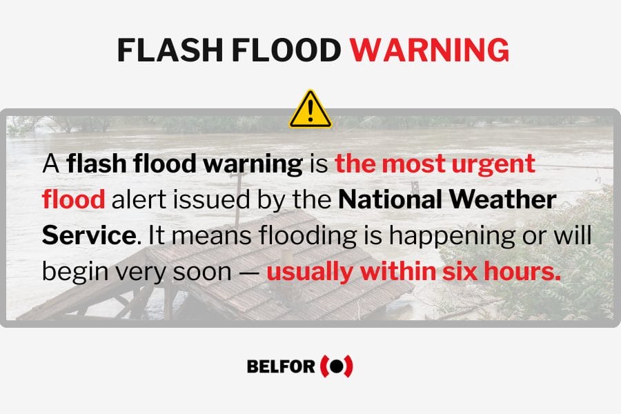
Flash Flood Warnings vs. Flood Warnings vs. Aerial Flood Warnings
While they sound similar, these alerts indicate very different types of flood risk:
- Flood warning: Issued when flooding is imminent or already happening in known flood zones (like rivers or streams). There’s usually time to act.
- Flash flood warning: Issued when rapid-onset flooding is occurring or expected – typically due to intense rainfall, dam failure, or sudden water release.
- Aerial flood warning: A term for widespread, gradual flooding in low-lying areas, often due to prolonged rainfall or saturated ground. Unlike flash floods, these develop over hours or days but can still pose serious risks to property and travel.
Pro tip: If you receive a flash flood warning, move to higher ground immediately – do not wait until you can see rising water.
Why Accurate Flood Measurement Matters for Safety and Recovery
Accurate flood measurement isn’t just about data – it’s about saving lives, protecting property, and accelerating recovery.
Accurate flood measurement is important because:
- Flood warnings save lives: With precise flood measurement tools, officials can issue timely evacuation orders and flood alerts. According to FEMA, just 6 inches of fast-moving water can knock over an adult, while 12 inches can carry away a small car. Accurate measurements help communities avoid these dangers.
- Better resource deployment: When responders know exactly where water levels are rising, they can prioritize sandbagging efforts, reroute traffic, and set up temporary shelters before conditions worsen.
- Insurance and documentation: Verified flood data supports insurance claims and government aid applications. This information becomes essential when documenting property damage or proving a flood’s extent to secure funding or repairs.
- Restoration and mitigation: For restoration teams, flood data guides safe entry, moisture mapping, and long-term remediation. It ensures the right plan is in place – from water extraction to structural drying and mold damage prevention.
Pro Tip: After a flood event, request official flood stage reports or high-water mark records from local authorities. These documents can streamline your insurance claim and support professional cleanup and repairs.
Flood Measurement: Key Takeaways
- Floods are measured using stage height (how high water rises), discharge rate (how fast it flows), and other real-time data points.
- Stream gauges and remote sensors are essential tools for monitoring changing conditions and issuing flood warnings.
- The Flood Severity Index categorizes floods by impact, helping responders and property owners understand what’s at stake.
- Timely and accurate measurements reduce property damage, support insurance claims, and improve recovery timelines.
- Partnering with BELFOR means working with a team that understands the data – and knows exactly how to act on it to protect your property.
Partner With BELFOR for Expert Flood Damage Assessment and Recovery
When floodwaters strike, every second counts. At BELFOR, we move fast to protect what matters most – your safety, your property, and your peace of mind.
Our teams are trained to assess flood damage with precision and respond with industry-leading restoration solutions, including specialties such as contents restoration solutions.
When you choose BELFOR, you can count on:
- Accurate flood damage assessments: We use advanced tools to detect moisture, structural damage, and hidden risks – ensuring no issue goes unnoticed.
- Rapid mitigation and restoration: From water extraction to structural drying and repairs, we act fast to stop further damage and begin the water damage restoration process.
- Certified professionals: Our technicians follow IICRC, EPA, and all local, federal, and industry standards to restore your home or business safely and thoroughly.
- Support with insurance claims: We document every step of the damage and recovery process to help streamline communication with your insurance provider.
- 24/7 response: Flooding doesn’t follow a schedule and neither do we. Our emergency services are on call around the clock.
Protect your property and restore peace of mind. Contact BELFOR today to schedule your professional flood damage assessment. We’re here and ready to help, whenever you need us.